Dublin Core
Title
Description
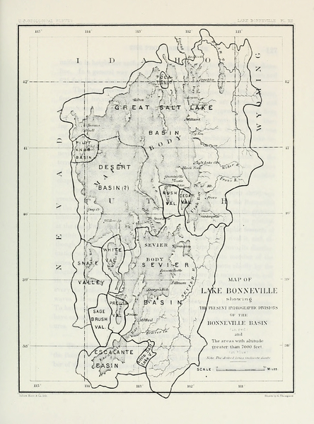
Although short on rainfall, Utah’s west desert supports significant bodies of water. In the 1870s, geologist Grove Karl Gilbert discovered that these delicate environments depend on the same stream water as our farms.
Gilbert set out to better understand the Western landscape, in part by studying Utah’s terminal lakes, which are bodies of water with no outlet. By examining Great Salt Lake’s shoreline, Gilbert observed that the high water mark of the late 1860s and early 1870s was well above that of 1850. Could the presence of Mormon settlers have made a difference in the lake’s water level?
Gilbert acknowledged that natural climate cycles may have been at work, but he also offered a theory that human activity had caused these higher water levels. It seems counterintuitive that lake and stream levels would rise with the arrival of more people, but in other arid states wetter conditions were also present in the first years of settlement. Gilbert calculated that several factors were at play. Farmers built ditches that drained stagnant lands into the lake. Their livestock trampled the soil and introduced invasive vegetation that resulted in swifter runoff. Cutting down trees had the same effect.
For settlers with an incomplete understanding of Western water, the idea that settlement led to a wetter landscape would have been great news. But by the 1880s, Gilbert noticed lake levels falling, and once again, he suspected human activity was a primary cause. He supposed that settlers up and down the Wasatch Front diverting local water sources for irrigation overwhelmed the delicate balance required to maintain relative equilibrium in the territory’s terminal lakes. Drought conditions compounded the situation and led to the shrinking of Great Salt Lake and Sevier Lake in Utah’s west desert. This is an all too familiar story to contemporary conservationists, who have been watching Great Salt Lake dwindle for decades.
The debate continues over just how much agricultural--and municipal--water to divert from the rivers that feed our terminal lakes. Gilbert’s early research lends us valuable insight into just how delicate the balance of water in Western waterways can be.
Creator
Source
_______________
See Grove Karl Gilbert, Lake Bonneville (Washington, DC: Government Printing Office, 1890), 240-51; John Wesley Powell, Report on the Lands of the Arid Region of the United States, ed. Wallace Stegner (Cambridge, MA: The Belknap Press of Harvard University Press, 1962), 95-106, 127-41.

